Η ρεματιά Χαλανδρίου αποτελεί μια όαση για όσους θέλουν να ξεφύγουν από τη φασαρία της πόλης. Η ρεματιά διασχίζει μεγάλο μέρος του Δήμου Χαλανδρίου ξεκινώντας από τις παρυφές του όρους Πεντέλης. Η πρόσβαση στη ρεματιά είναι εύκολη καθώς μπορεί να πραγματοποιηθεί είτε από τη Λεωφόρο Πεντέλης (από τις οδούς Δάσους και Κηφισού), είτε από τις οδούς Προφήτη Ηλία και Ροδοδάφνης, είτε από τη Βάρναλη. Μια διαδρομή στη ρεματιά μπορεί να φτάσει τα 4,5 χιλιόμετρα, ωστόσο σε πολλά σημεία θα συναντήσετε περιφράξεις.
Πρόσφατα, η Ανάβαση δημιούργησε δύο πολύ λεπτομερείς χάρτες για το Σύλλογο Προστασίας Περιβάλλοντος και Ρεματιάς Πεντέλης- Χαλανδρίου, ο οποίος διανέμεται δωρεάν σε έντυπη και σε ψηφιακή μορφή. Η ψηφιακή έκδοση των χαρτών της ρεματιάς Πεντέλης και Χαλανδρίου είναι διαθέσιμα δωρεάν μέσα στην εφαρμογή μας, Anavasi mapp.
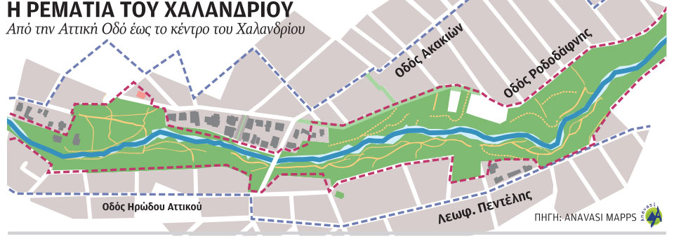
Διαδρομή
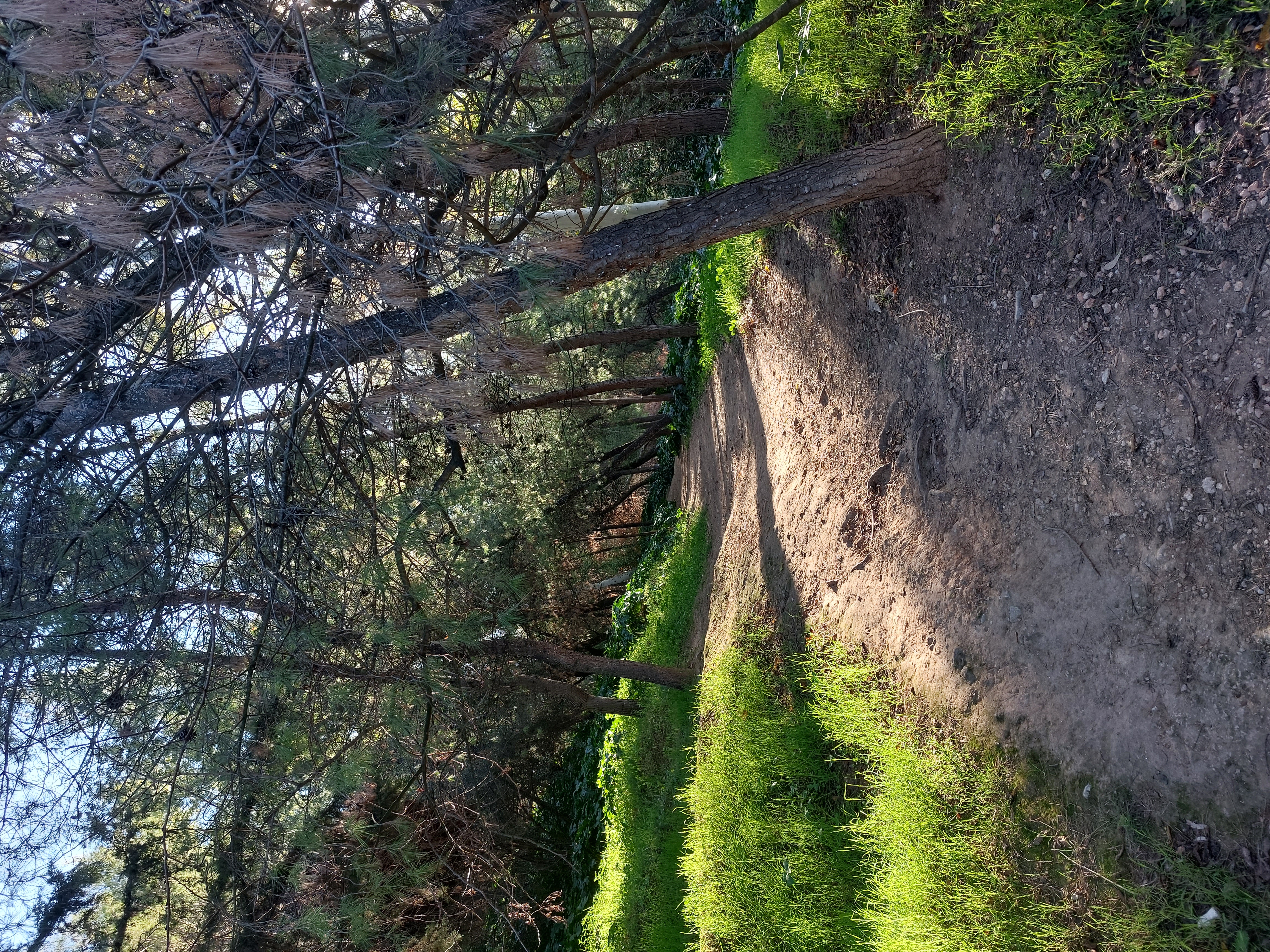
Η κοίτη του ρέματος είναι σε πολλά σημεία πλημμυρισμένη με πεύκα. Ξεκινήστε τη διαδρομή σας από την οδό Ευρίπου και την εκκλησία του Αγίου Αθανασίου. Από αυτό το σημείο ξεκινά μονοπάτι που κατευθύνεται προς νότια δίπλα στο ρέμα. Το μονοπάτι διασχίζει σε όλο του το μήκος την κατάφυτη όχθη της ρεματιάς, χαρίζοντας στους επισκέπτες στιγμές όασης. Το μονοπάτι κινείται παράλληλα της οδού Ηρώδου Αττικού και περνά από τις οδούς Πολυδρόσου και Δαφνίδος.
Το μονοπάτι διακόπτεται σε πολλά σημεία από περιφράξεις, ωστόσο μπορείτε εύκολα να το εντοπίσετε και να συνεχίσετε την πορεία σας.
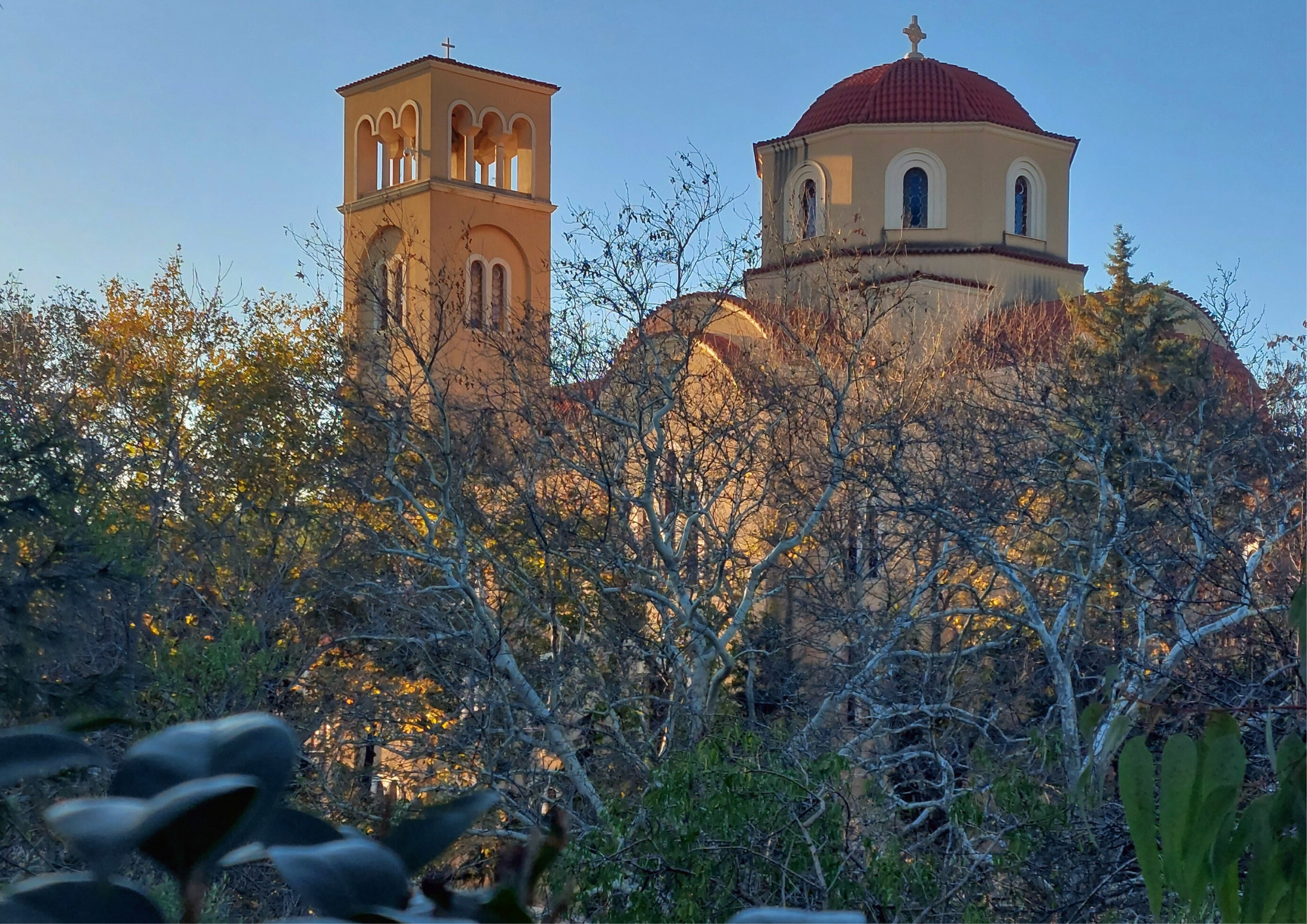
Στην οδό Νυμφών θα βρείτε μονοπάτι με σκαλιά που καταλήγει σε μεταλλική πεζογέφυρα. Διασχίζοντας την πεζογέφυρα πάνω από το ρέμα φτάνετε σε πλάτωμα κάτω από την εκκλησία του Προφήτη Ηλία. Το σημείο αυτό προσφέρεται για ξεκούραση καθώς διαθέτει τραπέζια για πικ - νικ. Από αυτό το σημείο όλα τα μονοπάτια καταλήγουν στις οδούς Διάκου, Προφήτη Ηλία και σε αδιεξόδους.
.jpg)
Αδριάνειο Υδραγωγείο
Το Αδριάνειο Υδραγωγείο (134 μ.Χ.), κατά τη ρωμαϊκή περίοδο υδροδοτούσε την πόλη των Αθηνών μεταφέροντας νερό από την Πεντέλη ώς την Αδριάνεια Δεξαμενή στους πρόποδες του Λυκαβηττού. Η κατασκευή του Αδριάνειου Υδραγωγείου ξεκίνησε το 134 μ.Χ. από τον Ρωμαίο αυτοκράτορα Αδριανό και ολοκληρώθηκε το 140 μ.Χ. από τον Πίο Αντωνίνο. Οι φανοί που βρέθηκαν κοντά στη Λεωφ. Κηφισίας αποκάλυψαν το υδραγωγείο, το οποίο αποτελεί πολιτιστική κληρονομιά της πόλης του Χαλανδρίου.
Κατά τους αρχαίους χρόνους, η ρεματιά ήταν το βόρειο σύνορο του Δήμου Φλύας (σημερινό Χαλάνδρι) με τον Δήμο Αθμονον (Μαρούσι), διότι οι αρχαίοι συνήθιζαν να χρησιμοποιούν γεωφυσικά ορόσημα για τα όριά τους.
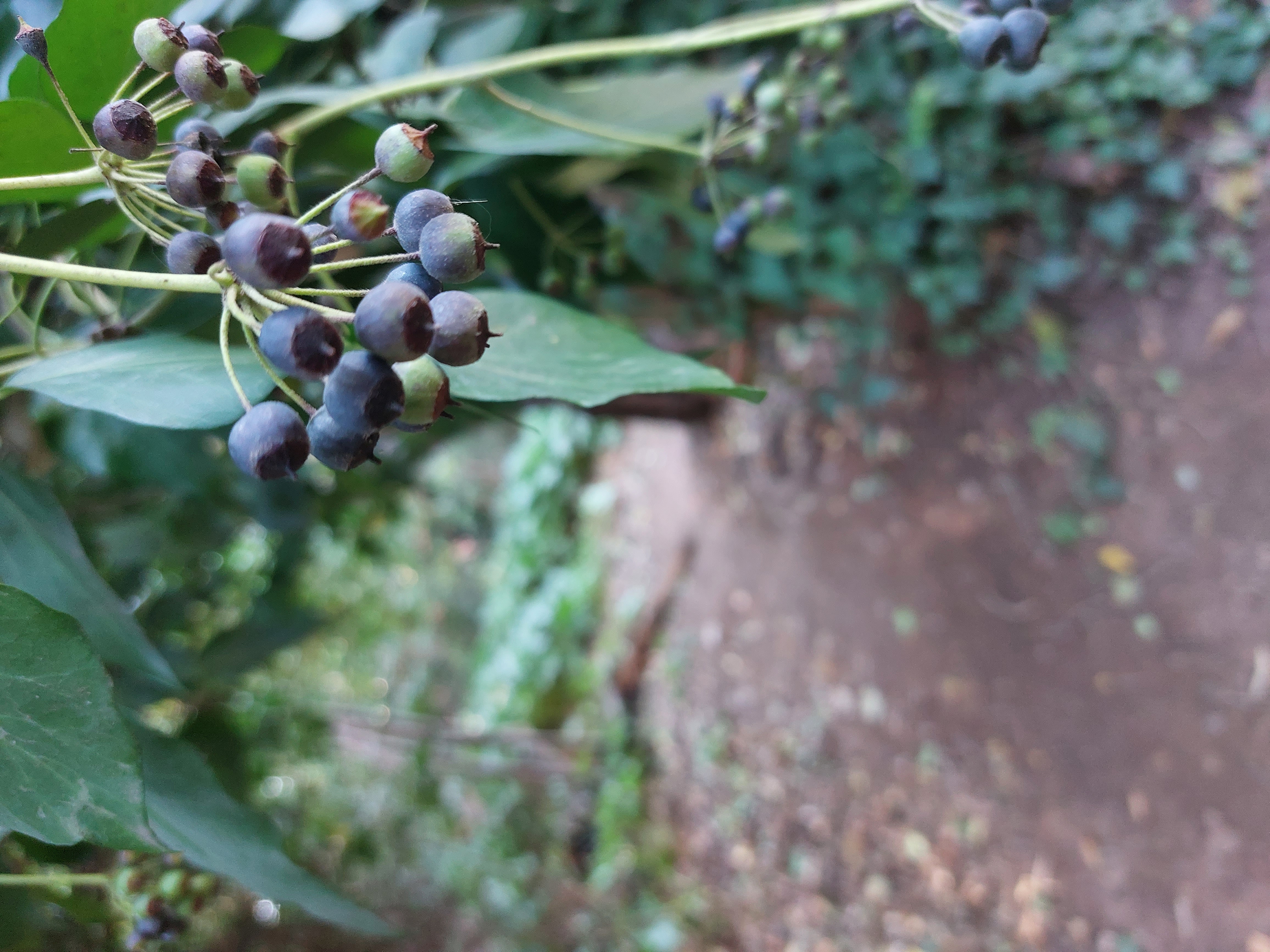
Χλωρίδα
Παρά τις αστικές παρεμβάσεις που έχει δεχθεί το Αττικό τοπίο τον τελευταίο αιώνα, η Ρεματιά είναι από τα λίγα σημεία των Αθηνών που έχουν μείνει αναλλοίωτα. Μεγάλο μέρος της ρεματιάς καλύπτεται από πεύκα, ενώ ακολουθούν πεύκα, κυπαρίσσια, ευκάλυπτους, ελιές, αμυγδαλιές, και άλλα είδη από την πλούσια χλωρίδα της Ρεματιάς. Στα παλαιότερα χρόνια, η περιοχή της Ρεματιάς ήταν δρυόδασος. Περίπου 150 φυτά έχουν καταγραφεί στη Ρεματιά εκ των οποιών το 80% είναι ενδημικά.
Πανίδα
Στη ρεματιά θα συναντήσετε πλήθος πτηνών όπως ο σπιτοσπουργίτης, το περιστέρι, η δεκαοχτούρα και η καρακάξα. Ακόμη θα συναντήσετε και “μη αστικά” πτηνά όπως ο κότσυφας, η σταχτοσουσουράδα, ο καλόγηρος, η καρδερίνα κ.α. Την άνοιξη εκτός από τα χελιδόνια μπορείτε να συναντήσετε και ενδημικά πτηνά. Χαρακτηριστικό, επίσης, είναι ο γκιώνης, πτηνό που μοιάζει με κουκουβάγια.