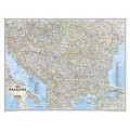
National Geographic’s Classic political map of Europe combines elegant cartographic art with unparalleled accuracy. Featuring rich shaded relief, coastal bathymetry, and clear international boundaries, it is as visually striking as it is functional. Please note: Map text and place names are printed in English.
Full Description: Explore the European continent with this detailed reference map from National Geographic. Designed with a timeless, tasteful color palette, this map highlights thousands of place names, major transit routes, national parks, and key geographic features across every European nation.
Key Features:
Map Language: English
Comprehensive Detail: Clear international borders, major highways, airports, water bodies, national parks, and ocean depths.
Featured Countries: Albania, Armenia, Austria, Azerbaijan, Belarus, Belgium, Bosnia & Herzegovina, Bulgaria, Croatia, Cyprus, Czech Republic, Denmark, Estonia, Finland, France, Georgia, Germany, Greece, Hungary, Iceland, Ireland, Italy, Kosovo, Latvia, Liechtenstein, Lithuania, Luxembourg, Moldova, Montenegro, Netherlands, North Macedonia, Norway, Poland, Portugal, Romania, Russia, Serbia, Slovakia, Slovenia, Spain, Sweden, Switzerland, Turkey, Ukraine, and the United Kingdom.