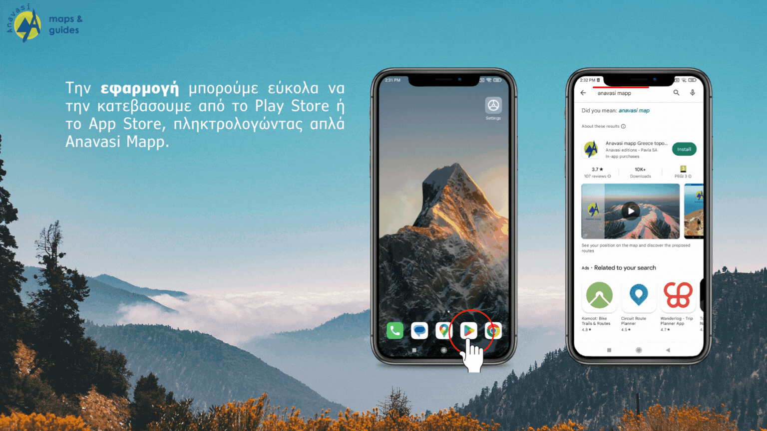
ANAVASI MAPP - Χάρτες πεζοπορίας για τα Βουνά και τα Νησιά της Ελλάδας
Το Anavasi mapp ειναι μια απλή και εύχρηστη εφαρμoγή.
Δείχνει με ακρίβεια τη θέση μας πάνω στο χάρτη ΧΩΡΙΣ να χρειάζεται ίντερνετ ή δεδομένα κινητής τηλεφωνίας, Λειτουργεί OFF Line.
![]()
![]()
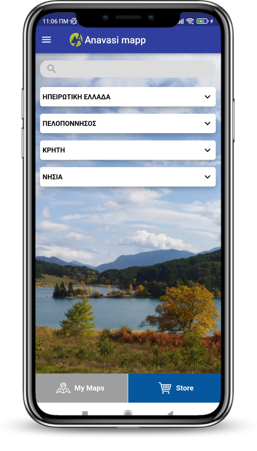
120 και πλέον χάρτες σε ψηφιακή μορφή
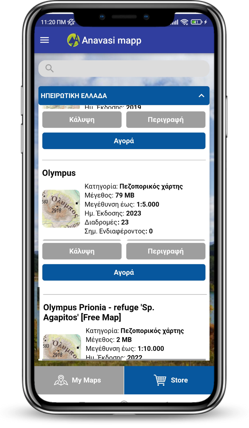
Οι χάρτες είναι ομαδοποιημένοι γεωγραφικά. Ανοίξτε την ομάδα που σας ενδιαφέρει και επιλέξτε το χάρτη που επιθυμείτε.
Αγοράστε τον εύκολα μέσα απο την εφαρμογη, πατώντας απλά “Αγορά”.
.png)
Δες τη θέση σου στο χάρτη
ΧΩΡΙΣ τη χρήση δεδομένων ή ίντερνετ
Όλοι οι χάρτες στο Anavasi mapp λειτουργούν off line χωρίς τη χρήση δεδομένων .
Η θέση σου εντοπίζεται από το GPS του κινητού και απεικονίζεται με ακρίβεια στο χάρτη με μια μπλέ κουκίδα.
Περιηγηθείτε στο χάρτη ακουμπώντας την οθόνη και σέρνοντας το δάχτυλό σας προς όποια κατεύθυνση επιθυμείτε.
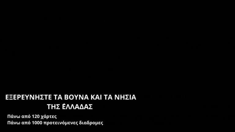
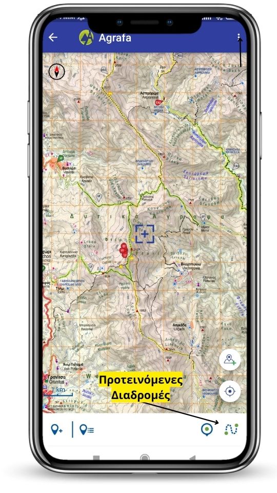
Πάνω από 1000 προτεινόμενες διαδρομές
Δείτε τη λίστα με τις προτεινόμενες διαδρομές του χάρτη.
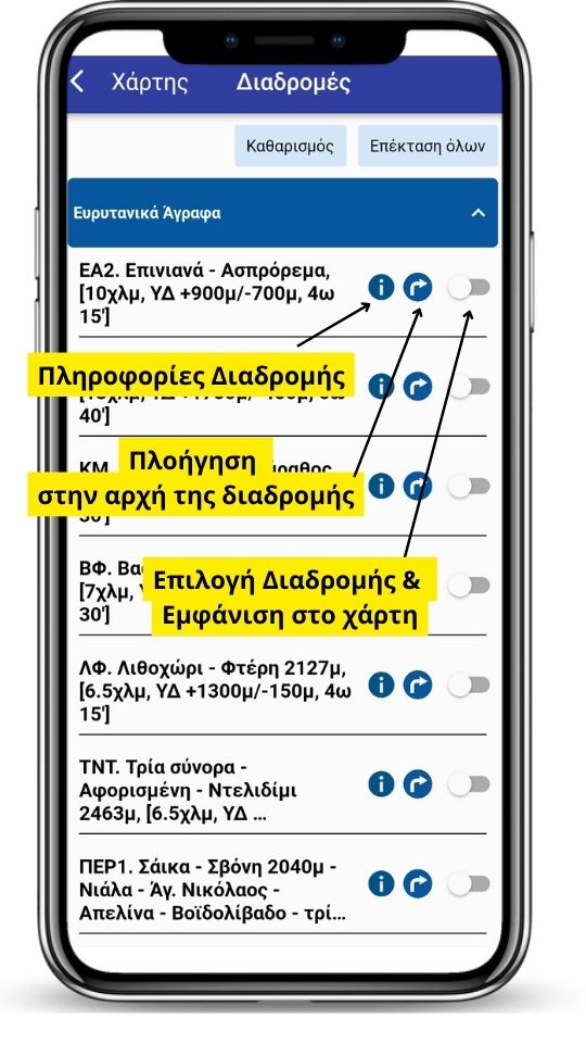
Για κάθε διαδρομή υπάρχουν
- Μετρητικά Στοιχεία [Απόσταση, Υψομετρική Διαφορά, Εκτιμώμενος Χρόνος]
- Πλοήγηση στην αρχή της Διαδρομής
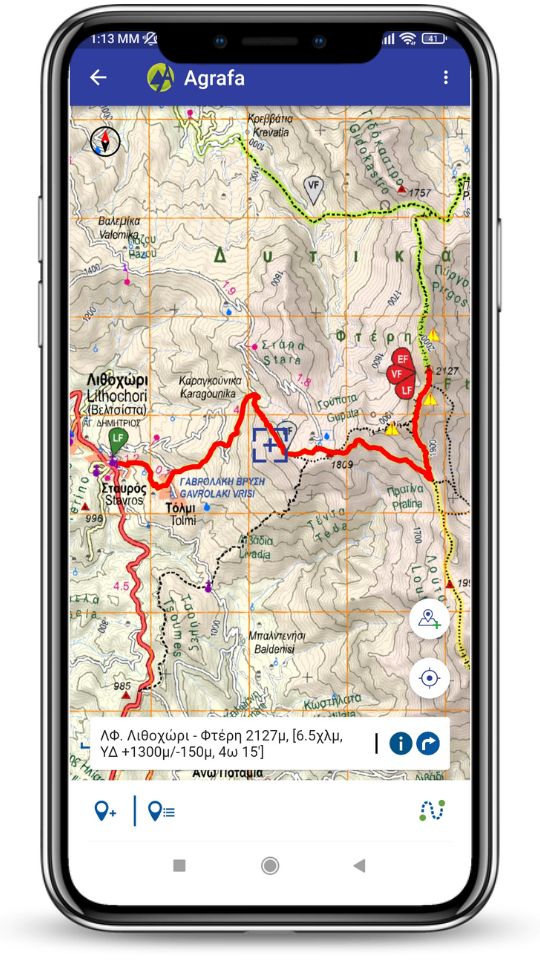
Δες τη διαδρομή στο Χάρτη
Επιλέγοντας μία προτεινόμενη διαδρομή εμφανίζεται με έντονο χρώμα στο χάρτη.
Υπάρχει χρωματικός κώδικας που προσδιορίζει τη δυσκολία της διαδρομής
- Ροζ: Πολύ εύκολη
- Πράσινο: Εύκολη
- Μπλέ: Μέτρια
- Κόκκινο: Δύσκολη
- Μαύρο: Πολύ Δύσκολη
Με tap πάνω στην επιλεγμένη διαδρομή εμφανίζεται, το όνομά της μάζι με τα μετρητικά στοιχεία. Καθώς και δυνατότητα εμφάνισης των πληροφοριών της και πλοήγηση στην αρχή της.
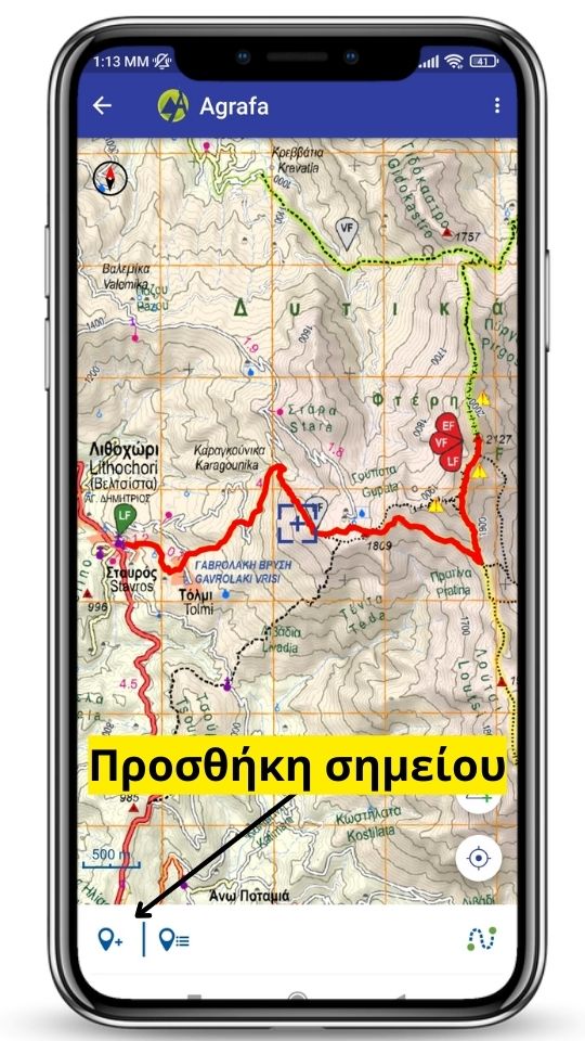
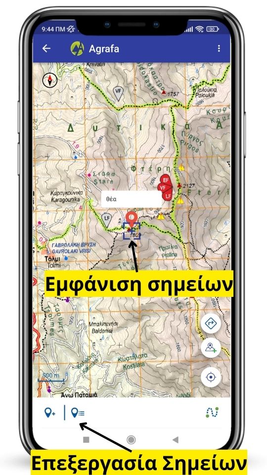
Πρόσθεσε τα δικά σου σημεία
Πρόσθεσε τα δικά σου σημεία ενδιαφέροντος με
- Τίτλο
- Περιγραφή
- Φωτογραφία
και δες τα στο χάρτη.
Διαχειρίσου τα σημεία σου από την αντίστοιχη καρτέλα.
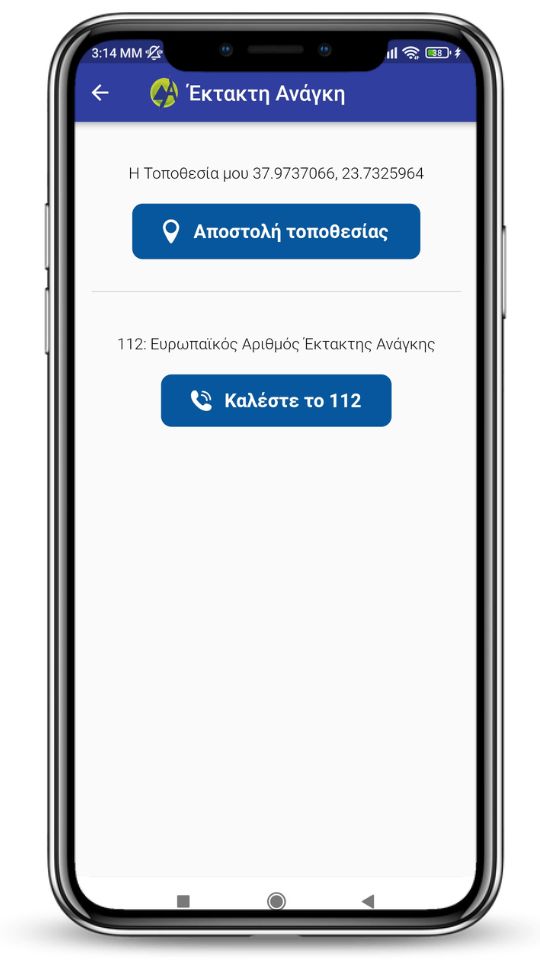
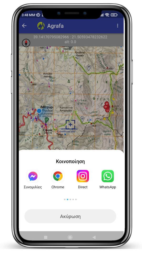
Αποστολή Τοποθεσίας
Άμεση και εύκολη αποστολή της τοποθεσίας σου με SMS, Viber, Messenger, WhatsApp, Email κλπ
Σε περίπτωση Έκτακτης Ανάγκης απευθείας κλήση στο 112
Disclaimer: Ο ψηφιακός χάρτης είναι συμπλήρωμα του έντυπου και δεν τον υποκαθιστά.
Η Ανάβαση έχει καταβάλει κάθε προσπάθεια για την ακρίβεια, πληρότητα και εγκυρότητα της αποτύπωσης των δεδομένων στους χάρτες της, χωρίς να παρέχει καμία εγγύηση για το απολύτως ακριβές ή το χρόνο εγκυρότητας των αποτυπώσεων αυτών, ούτε να αναλαμβάνει οποιαδήποτε ευθύνη για τυχόν ζημίες ή βλάβες του χρήστη ή τρίτου, που ενδέχεται να προκύψουν ένεκα οποιασδήποτε χρήσης των χαρτών.
ΒΙΝΤΕΟ ΣΥΝΟΠΤΙΚΩΝ ΟΔΗΓΙΩΝ